The Brahmaputra River System is one of the most significant river systems in Asia and holds paramount importance for the UPSC Civil Services and APSC examinations. It is the longest river in Assam, the lifeline of Northeast India, and one of the largest river systems in the world by discharge volume and drainage basin. Understanding the brahmaputra river system is critical not only for geography preparation but also for topics related to environment, disaster management, international relations, and economic geography.
| Quick Facts at a Glance Total Length: ~2,900 km | Origin: Chemayungdung Glacier, Tibet | Mouth: Bay of Bengal | Drainage Basin: ~651,334 sq km | Average Discharge: ~19,800 m³/s | Countries Covered: China, India, Bangladesh |
1. Origin and Course of the Brahmaputra River
1.1 Origin
The Brahmaputra originates from the Chemayungdung (Chema-yung-dung) Glacier near Lake Mansarovar in the Tibetan Plateau at an altitude of approximately 5,300 metres above sea level. In Tibet, it is known as the Tsangpo, which means ‘the purifier.’ It flows eastward for about 1,625 km through Tibet before making a dramatic U-turn (hairpin bend) around the Namcha Barwa peak (7,756 m) in the Himalayas.
1.2 Three Sections of Flow
| Section | Region / Country | Local Name |
| Upper Course | Tibetan Plateau (China) | Tsangpo / Yarlung Tsangpo |
| Middle Course | Arunachal Pradesh & Assam (India) | Siang → Dihang → Brahmaputra |
| Lower Course | Bangladesh | Jamuna |
1.3 Entry into India
The river enters India through Arunachal Pradesh as the Siang (also called Dihang). After receiving its major tributaries — the Dibang and Lohit — it broadens and is officially called the Brahmaputra from Sadiya onwards. The river then flows westward through the Assam Valley for about 700 km before entering Bangladesh.
2. Brahmaputra Map — Geographical Overview
Understanding the brahmaputra map is essential for both UPSC and APSC aspirants. The following geographical data summarises the river’s spatial extent:
| Geographical Parameter | Details |
| Origin Point | Chemayungdung Glacier, Tibet (~5,300 m) |
| Tibetan Length | ~1,625 km (flows eastward as Tsangpo) |
| Length in India | ~918 km (Arunachal Pradesh + Assam) |
| Length in Bangladesh | ~337 km (as Jamuna) |
| Total Length | ~2,900 km |
| Outlet | Meghna Estuary → Bay of Bengal |
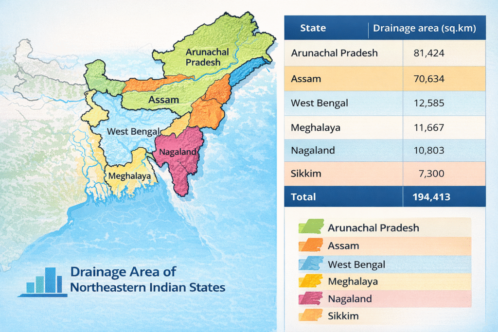
| Drainage Area | ~651,334 sq km (transboundary) |
| Average Width (Assam) | 8–10 km (one of the widest in the world) |
| Altitude of Origin | ~5,300 m above sea level |
| Brahmaputra Map Note for APSC/UPSC On the brahmaputra map, note that the river flows EASTWARD in Tibet, makes a sharp hairpin bend near Namcha Barwa, then flows WESTWARD through Assam. This reversal of flow is a unique geographical feature frequently asked in competitive exams. |
3. Major Tributaries of the Brahmaputra River System
The brahmaputra river system is fed by numerous tributaries, broadly classified into left-bank (north-bank) and right-bank (south-bank) tributaries.
3.1 Left-Bank (North-Bank) Tributaries
These originate from the Himalayas and Arunachal Pradesh and carry heavy sediment load:
- Subansiri (Gold River) — Largest north-bank tributary; originates in Tibet
- Jia Bharali (Kameng) — Originates from Arunachal Pradesh
- Dhansiri (North) — Flows from Nagaland hills
- Puthimari — Originates from Bhutan foothills
- Pagladiya — Flows through Bodoland area
- Manas — Originates from Bhutan; a World Heritage Site
- Sankosh — Forms boundary between Assam and West Bengal
3.2 Right-Bank (South-Bank) Tributaries
These originate from the Meghalaya Plateau and hill ranges:
- Subansiri (lower portion enters from south) — Note: partly right bank
- Burhi Dihing — Originates from Patkai Hills
- Disang — Flows through tea garden areas of Assam
- Dikhow — Flows near Sibasagar
- Dhansiri (South) — Distinct from the north-bank Dhansiri
- Kopili — Originates from Meghalaya; major south-bank tributary
- Digboi Nala / Beki — Flows near Manas area
| North-Bank Tributaries | South-Bank Tributaries |
| Subansiri | Burhi Dihing |
| Jia Bharali (Kameng) | Disang |
| Puthimari | Dikhow |
| Manas | Kopili |
| Sankosh | Dhansiri (South) |
4. Physical Characteristics of the Brahmaputra
4.1 Discharge and Width
The Brahmaputra is one of the largest rivers in the world by discharge. Its average annual discharge at the mouth is approximately 19,800 m³/s, making it the 9th largest river by discharge in the world. In Assam, the river is extraordinarily wide — averaging 8 to 10 kilometres — and during floods can expand to over 20 kilometres.
4.2 Braided Channel
A key feature of the brahmaputra river system visible on any brahmaputra map is its braided channel pattern in the Assam Valley. The river divides into multiple channels, creating numerous mid-channel islands (locally called ‘chars’). The famous Majuli Island — the world’s largest river island — is formed by the braided channels of the Brahmaputra and its tributaries.
4.3 Sediment Load
The Brahmaputra carries one of the highest sediment loads of any river globally. It transports approximately 735 million tonnes of sediment annually. This high sediment load is responsible for the formation of riverine islands, changing channels, and frequent flooding in Assam. The heavy sediment load results from intense erosion in the geologically young and tectonically active Himalayan ranges.
| High-Yield Fact for UPSC/APSC The Brahmaputra is one of only three rivers in the world to have an antecedent origin — meaning the river is older than the mountains through which it flows. The other two are the Indus and the Sutlej. This is a frequently repeated MCQ fact in competitive exams. |
5. Antecedent Drainage — A Key Concept
The Brahmaputra is a classic example of antecedent drainage. The river existed before the Himalayas were uplifted. As the Himalayan ranges rose due to tectonic forces, the river maintained its original course by cutting through the rising mountains, forming spectacular gorges. This is why the Brahmaputra Gorge near Namcha Barwa is one of the deepest gorges in the world (~5,000 m deep), even deeper than the Grand Canyon.
6. Important Islands in the Brahmaputra River System
| Island | Location | Significance |
| Majuli | Between Brahmaputra & Kherkutia Suti, Assam | World’s largest river island; UNESCO heritage site candidate |
| Umananda | Guwahati, Assam | World’s smallest inhabited river island |
| Peacock Island | Guwahati | Umananda alternate name; Shiva temple |
| North Guwahati Island | Kamrup, Assam | Urbanised riverine island |
7. Brahmaputra Flooding — A Major Concern
7.1 Causes of Floods
- Excessive monsoonal rainfall in the catchment area (among the highest in the world)
- High sediment deposition raises the riverbed, reducing carrying capacity
- Earthquakes disturb the topography; the 1950 Assam Earthquake changed the river’s course
- Glacial melt from the Himalayas adds to the water volume
- Narrow valleys and absence of floodwater storage
7.2 Impact of Flooding
Annual floods in Assam affect millions of people and vast tracts of agricultural land. The floods are particularly devastating in districts such as Dhemaji, Lakhimpur, Dibrugarh, Majuli, Barpeta, and Morigaon. According to estimates, Assam loses significant forest cover and agricultural land each year due to river erosion (called ‘bhaanga’ in Assamese).
| Disaster Management Angle (UPSC GS-III) The brahmaputra river system floods are a recurring disaster. The National Disaster Management Authority (NDMA) has specific guidelines for Assam flood management. This is important for UPSC GS Paper III (Disaster Management) and APSC mains. |
8. Ecological and Environmental Significance
8.1 Biodiversity Hotspot
The Brahmaputra floodplain is a globally significant biodiversity corridor. It supports unique wetland ecosystems (beels), grasslands, and forests. Several protected areas lie within the brahmaputra river system basin:
- Kaziranga National Park — UNESCO World Heritage Site; home to the one-horned rhinoceros
- Manas National Park — UNESCO World Heritage Site and Tiger Reserve
- Dibru-Saikhowa National Park — Habitat of the feral horse
- Orang National Park — Mini Kaziranga along the Brahmaputra
- Pobitora Wildlife Sanctuary — Highest density of one-horned rhinos
8.2 Wetlands and Beels
The river system maintains numerous ‘beels’ (oxbow lakes and wetlands) in the Assam Valley, which serve as critical habitats for migratory birds, fish, and aquatic biodiversity. The Deepor Beel near Guwahati is a Ramsar Wetland of International Importance.
9. International Dimensions of the Brahmaputra River System
9.1 China’s Role
China has constructed several dams on the Yarlung Tsangpo in Tibet, raising concerns in India about water diversion, reduced dry-season flows, and artificial flooding. China’s plans for the Motuo (Medog) hydropower project — potentially the world’s largest — have heightened tensions. India has consistently demanded a data-sharing agreement and transparency on upstream constructions.
9.2 India-Bangladesh Relations
As the Jamuna in Bangladesh, the river merges with the Ganga (Padma) and the Meghna before emptying into the Bay of Bengal. This confluence zone (the Sundarbans delta) is the world’s largest mangrove forest. Water sharing and flood data are important aspects of India-Bangladesh bilateral relations.
| Country | Key Issue with Brahmaputra |
| China (Tibet) | Upstream dam construction; Motuo Hydropower Project; data sharing |
| India | Flooding; erosion; navigation; hydropower (NHPC projects) |
| Bangladesh | Jamuna river flow; delta management; Sundarbans |
10. Economic Importance of the Brahmaputra River System
10.1 Agriculture
The Brahmaputra floodplains of Assam are among the most fertile in India. The annual floods, while destructive, also deposit nutrient-rich alluvial soil that supports the cultivation of rice, jute, tea, and vegetables. Assam is the world’s largest tea-producing state, and tea gardens are concentrated in the Brahmaputra Valley.
10.2 Inland Waterways
The Brahmaputra is designated as National Waterway 2 (NW-2) by the Government of India, covering the Sadiya–Dhubri stretch of ~891 km. It is one of the most navigable rivers in India and serves as an important trade route connecting Assam with Bangladesh and beyond. The Inland Waterways Authority of India (IWAI) has developed infrastructure along this waterway.
10.3 Hydropower Potential
The brahmaputra river system has one of the highest hydropower potentials in India, estimated at over 66,000 MW — nearly 40% of India’s total hydropower potential. Major projects include the Lower Subansiri Hydroelectric Project (NHPC), Dibang Multipurpose Project, and the Kameng Hydro Electric Project in Arunachal Pradesh.
10.4 Fisheries
The river system supports rich freshwater fisheries. Golden Mahseer, Rohu, Catla, and various indigenous fish species are found in abundance. Fisheries form an important source of livelihood for riparian communities in Assam.
11. Brahmaputra River System — UPSC & APSC Exam Angles
| UPSC Prelims: High-Yield MCQ Points • Brahmaputra is known as Tsangpo in Tibet and Jamuna in Bangladesh • It originates from Chemayungdung Glacier near Lake Mansarovar • It is an example of antecedent drainage (like Indus and Sutlej) • Majuli is the world’s largest river island (Brahmaputra, Assam) • Deepor Beel is a Ramsar site on the Brahmaputra floodplain • NW-2 covers Sadiya–Dhubri (891 km) • Namcha Barwa hairpin bend is the defining feature on the brahmaputra map • Brahmaputra Gorge is deeper than the Grand Canyon |
| UPSC Mains / APSC Mains Essay Topics • Discuss the role of the Brahmaputra River System in the ecology and economy of Northeast India. • Critically examine China’s hydropower projects on the Yarlung Tsangpo and their implications for India. • Floods in Assam: Causes, consequences, and management strategies. • The Brahmaputra River System as a strategic waterway: Opportunities and challenges. • Conservation of biodiversity in the Brahmaputra floodplain ecosystems. |
12. Brahmaputra vs Other Himalayan Rivers — Comparative Table
| Feature | Brahmaputra | Ganga | Indus |
| Origin | Chemayungdung Glacier, Tibet | Gangotri Glacier | Sengge Zangbo, Tibet |
| Length | ~2,900 km | ~2,525 km | ~3,180 km |
| Direction in Tibet | Eastward | — | Westward |
| Entry into India | Arunachal Pradesh (as Dihang) | Uttarakhand | Ladakh |
| Drainage Type | Antecedent | Consequent | Antecedent |
| Major Feature | Majuli Island, Braided channel | Gangetic Plain | Indus Valley |
13. Recent Developments — Current Affairs Angle
- India and China have a Memorandum of Understanding (MoU) for sharing hydrological data during the flood season, though this has been suspended and resumed at different times.
- The National Water Development Agency (NWDA) has proposed river interlinking projects that include the Brahmaputra as a donor river.
- The Assam government has been implementing the Majuli Master Plan for erosion control and sustainable development of the world’s largest river island.
- NHPC’s Lower Subansiri Project remains contentious due to concerns from Assam about downstream flooding risks.
- The Jal Jeevan Mission includes projects in the Brahmaputra basin for rural water supply.
- Climate change projections suggest increased glacial melt will alter the flow regime of the brahmaputra river system significantly by 2050.
14. Conclusion
The Brahmaputra River System is far more than a geographical entity — it is the lifeblood of Northeast India, a biodiversity sanctuary, a geopolitical flashpoint, and an economic corridor. For APSC and UPSC aspirants, a thorough understanding of the brahmaputra river system encompasses physical geography, ecology, economics, international relations, and disaster management. Studying a detailed brahmaputra map alongside these notes will provide a comprehensive preparation foundation.
Whether you are revising for UPSC Prelims MCQs or writing detailed APSC Mains answers, the Brahmaputra River System remains one of the most dynamic, multi-dimensional, and high-scoring topics in the civil services syllabus.
| One-Minute Revision — Brahmaputra River System Tsangpo (Tibet) → Siang/Dihang (Arunachal Pradesh) → Brahmaputra (Assam) → Jamuna (Bangladesh) → Meghna → Bay of Bengal Origin: Chemayungdung Glacier | Length: ~2,900 km | Antecedent river | NW-2 (Sadiya–Dhubri) Majuli = World’s largest river island | Deepor Beel = Ramsar site | Kaziranga = UNESCO site |
Source – Brahmaputra River System